Sea Level Rise Vulnerability Assessment of Contaminated Sites
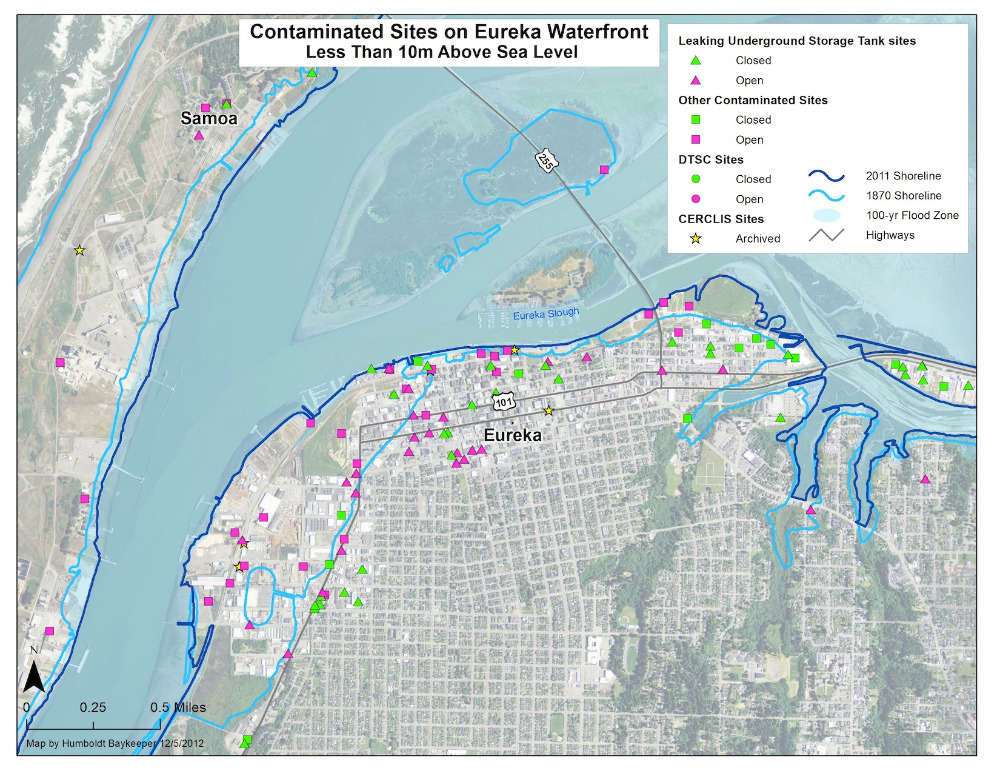
How we will prepare for rising sea levels is just beginning to take shape here in the Humboldt Bay region. Humboldt Baykeeper has assessed sea level rise vulnerability for contaminated sites near Humboldt Bay. More than 300 contaminated sites are within 10 meters of current sea level, including more than 40 that are below 2 meters – the amount sea level is projected to rise by the year 2100.


