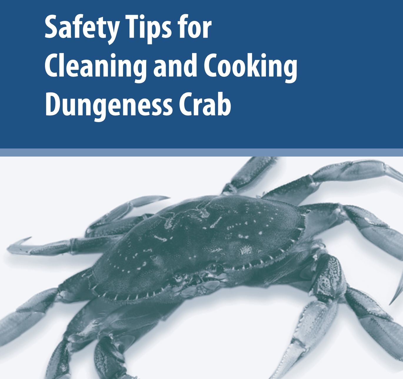
 The beginning of Dungeness crab season is always a time to celebrate, but with major concerns over the last few years regarding unsafe domoic acid levels, state health department officials continue to recommend not eating the internal organs (known as "crab butter").
Click HERE to download the brochure explaining this simple method of cleaning crabs before cooking to reduce your exposure to unsafe contaminants, including dioxins.The good news is that Dungeness crab are low in mercury - see our 2021 mercury guidelines for more info.
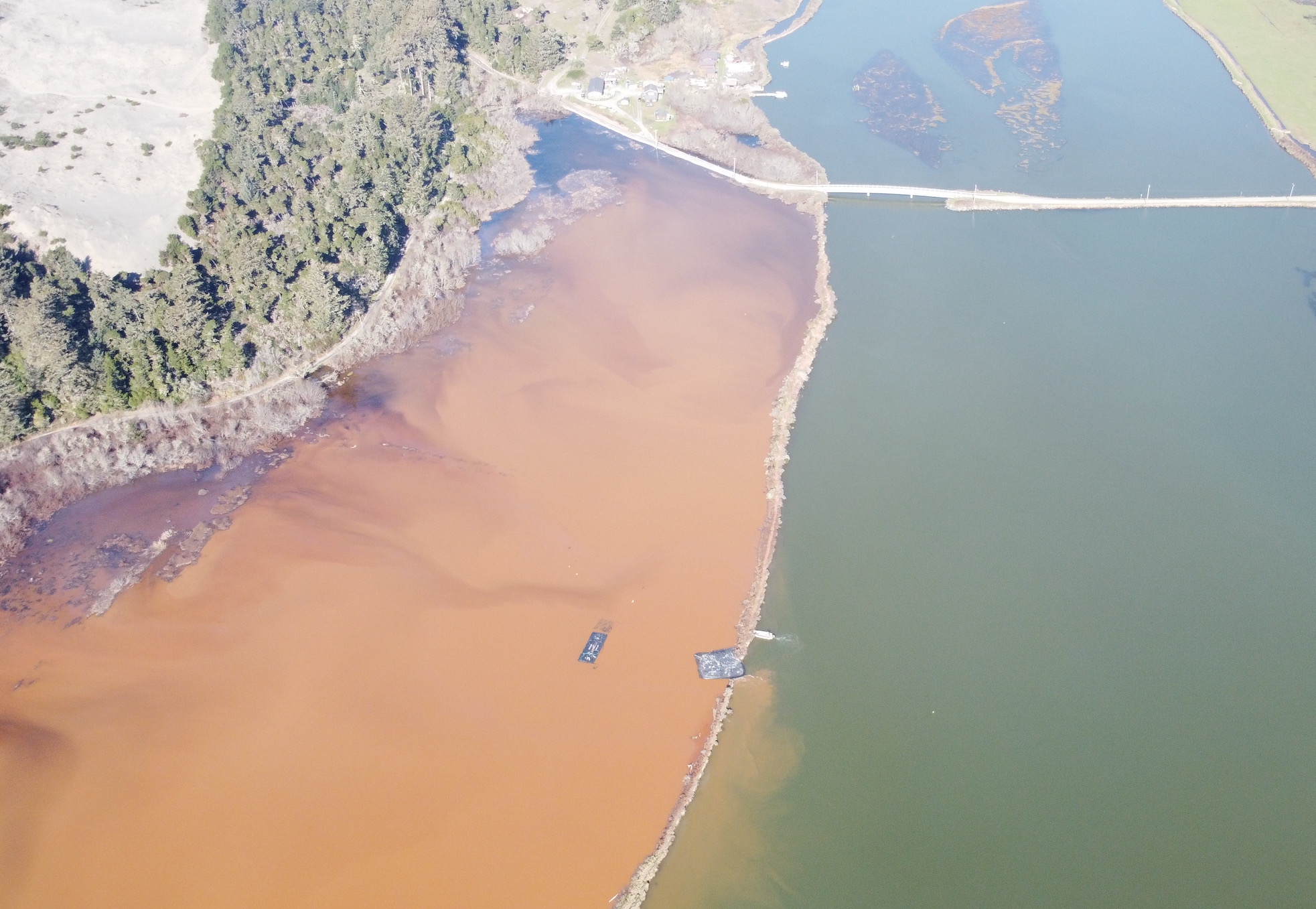 Starting in 1890, 40% Wigi (Humboldt Bay) was diked to convert public trust tidelands to private agricultural uses. Now 136 years later, sea level rise is enabling Wigi to begin reclaiming its stolen lands. In January, record King Tides breached a dike along Baduwa’t (Mad River) Slough. Photo by Todd Van Herpe, 2/2/26.
 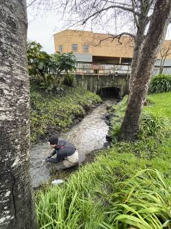 In 2020, 6PPD-quinone, the breakdown product of the tire preservative 6PPD, was identified as a major contributor to Urban Runoff Mortality Syndrome in the Puget Sound watershed, where adult Coho Salmon often die before spawning in areas with high concentrations of road runoff. Since then, studies have been done in San Francisco Bay, but little information is available beyond major metropolitan areas. This study is the first to examine concentrations of 6PPD-q in Humboldt County. Left: Alex Juan sampling Jolly Giant Creek in Arcata for 6PPD-quinone. Photo by Audrey Jackson, Wiyot Tribe Shawir Darrudaluduk.
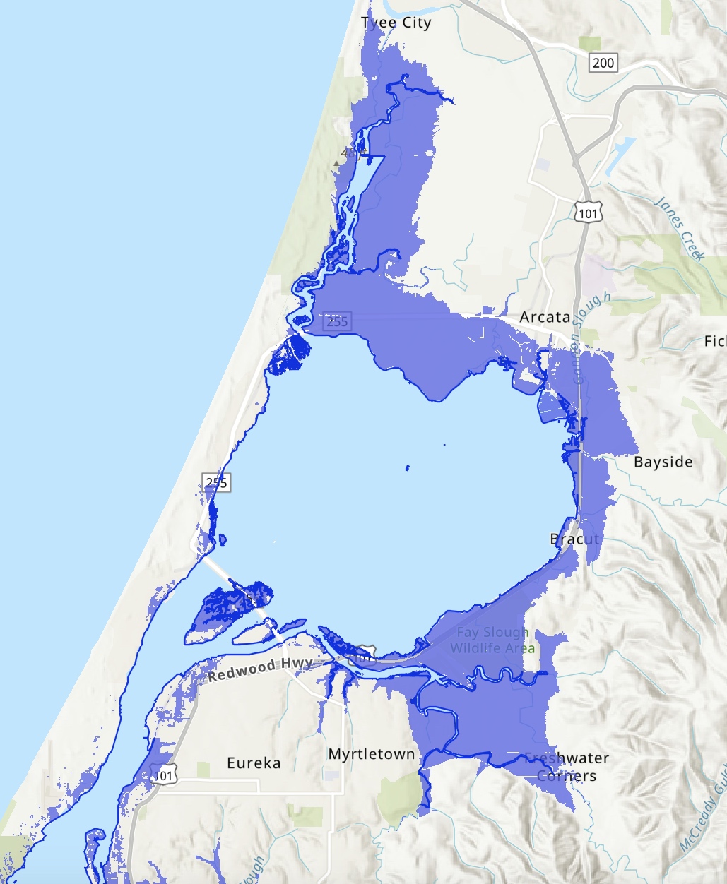
 Humboldt County's new
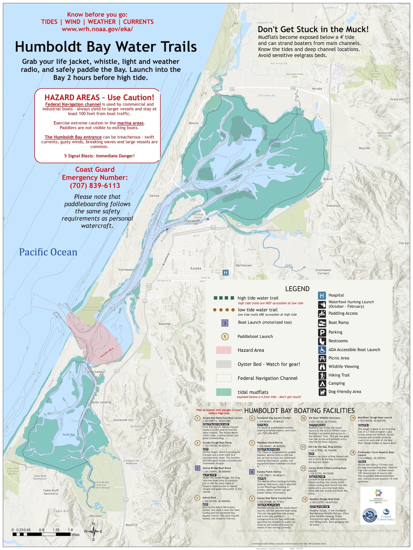
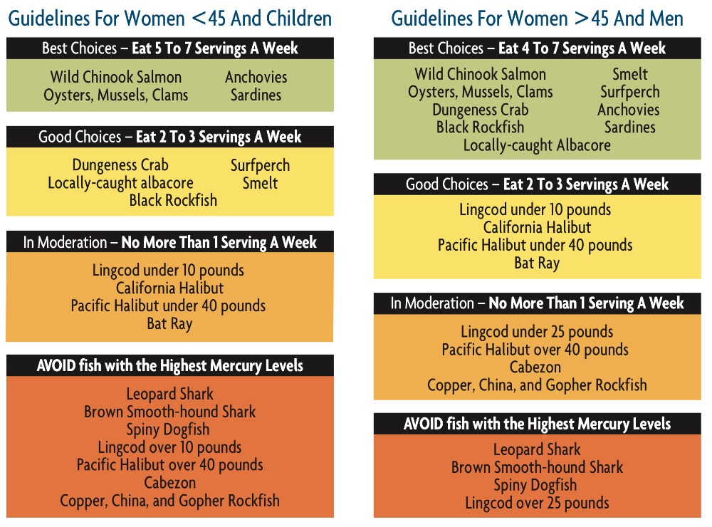 Our second study of mercury in local fish focused on nine species from nearshore coastal waters, including Pacific Halibut and several species of rockfish. We also sampled more Lingcod and California Halibut to add to the findings from our 2018 study. We found that most local fish are safe to eat in moderation—with a few exceptions.Download our mercury fliers in English, Spanish, or Hmong:

