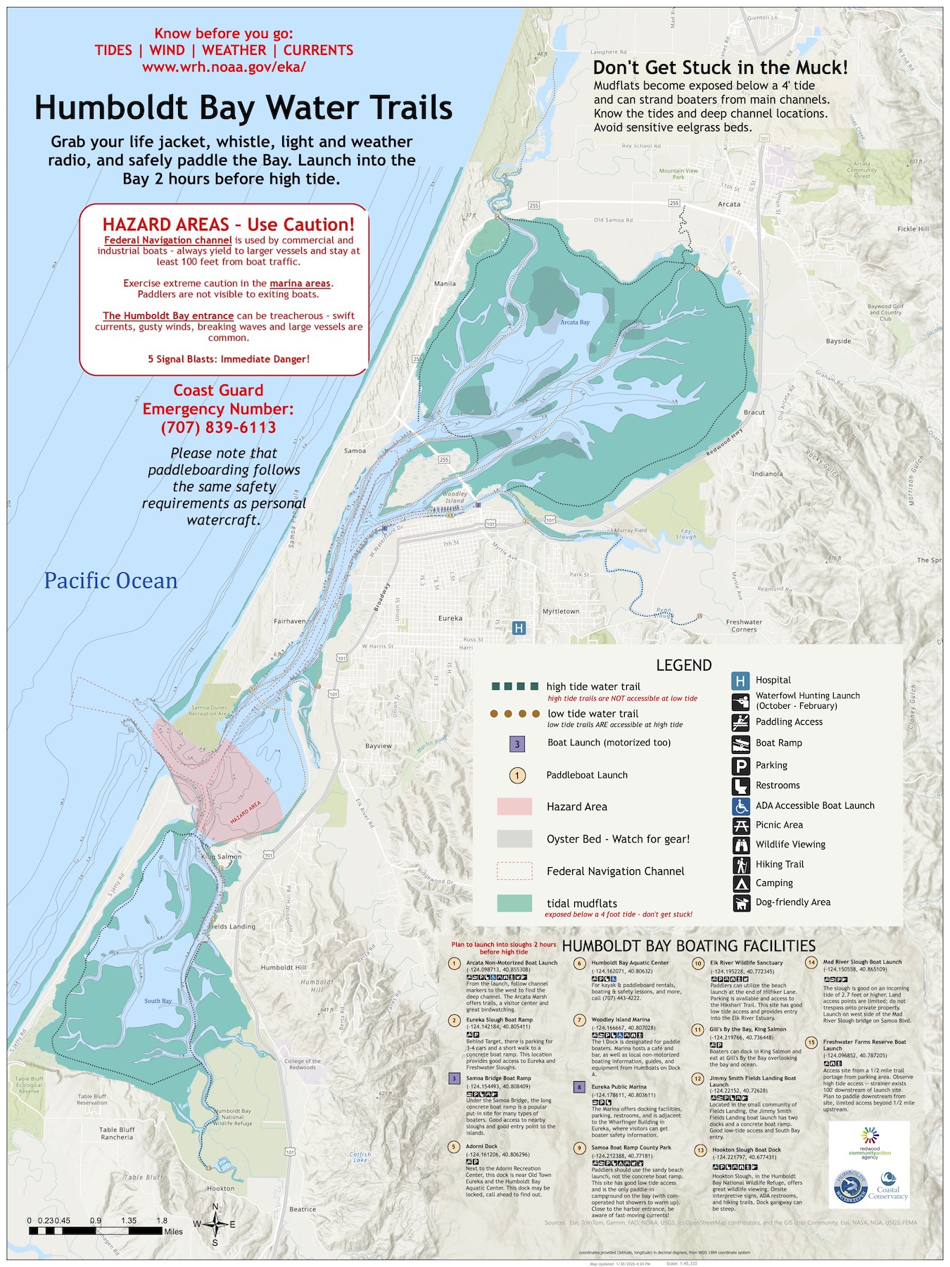
We are excited to announce the first digital version of the Humboldt Bay Water Trail map! The original Water Trail Map was developed by Redwood Community Action Agency in 2004.Humboldt Waterkeeper has breathed new life into the map, updating it with more accurate data on tidal mudflats and channel depths from NOAA’s navigational charts, and crowd-sourcing updates on the best boat launches.You can download our georeferenced PDF for mobile apps like Avenza, or access the interactive webmap directly in any browser.
 We are excited to announce the first digital version of the Humboldt Bay Water Trail map! The original Water Trail Map was developed by Redwood Community Action Agency in 2004.Humboldt Waterkeeper has breathed new life into the map, updating it with more accurate data on tidal mudflats and channel depths from NOAA’s navigational charts, and crowd-sourcing updates on the best boat launches.You can download our georeferenced PDF for mobile apps like Avenza, or access the interactive webmap directly in any browser.

