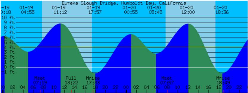
The high tides on January 19-20, 2011 were some of the highest tides of the year: between 8.25 and 8.85 feet above mean sea level around Humboldt Bay. We invited you to submit photos of areas known to flood and erode, and/or areas where the high water levels can be gauged against sea walls, jetties, bridge supports, dikes, or buildings around the Humboldt Bay Area. These images will help document the impacts coastal residents are likely to face with increasing frequency as sea level continues to rise.
Below are a few of the submitted photos.
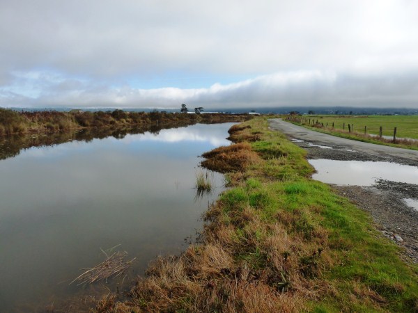
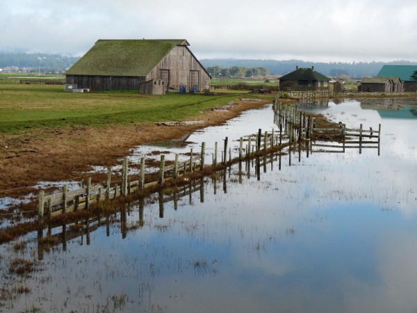
Left: County road near Liscom Slough, Arcata Bottoms. Right: Pasture near Liscom Slough, Arcata Bottoms. Photos by A. Laird.
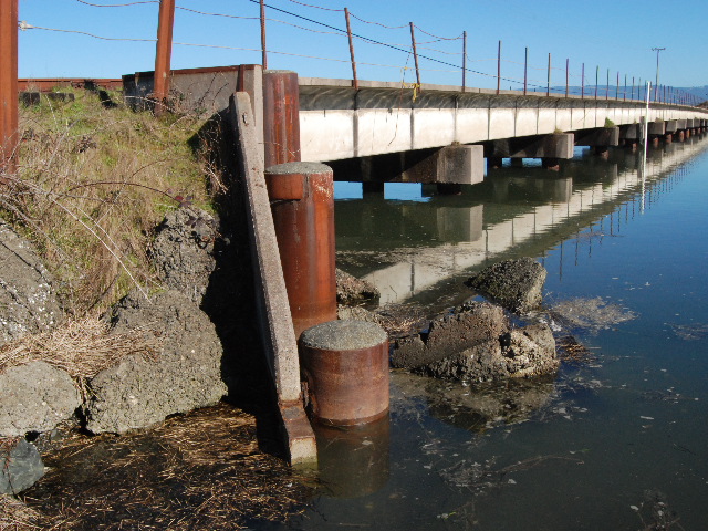
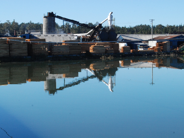
Left: Highway 255 bridge/Mad River Slough, Manila. Right: Sierra Pacific Industries mill/Mad River Slough, Manila. Photos by E. Coonen.
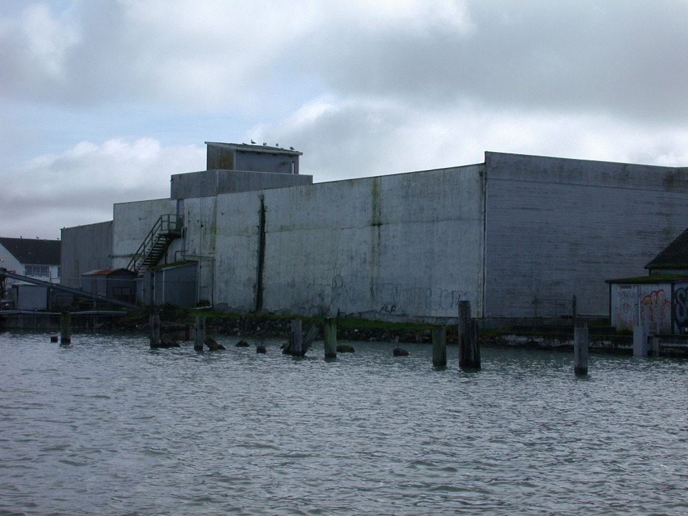
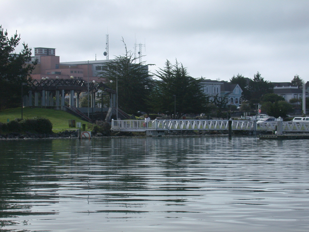
Left: Former Eureka Ice plant, Eureka. Right: Public dock at Halvorsen Park, Eureka. Photos by J. Kalt.
Climate Change, Sea Level Rise, and the King Tide
Increases in global sea levels have been recorded by NOAA tide gauges for many years, and more recent observations have been collected by NASA satellites. The steady rise has been attributed to warming of the oceans along with melting glaciers and land-based ice sheets. Climate modeling combined with these direct observations suggest sea level rise will continue well into the future with significant implications for the Humboldt Bay Area’s shoreline. Scientific analyses predict increases in sea level could be as high as 16 inches by 2050, with upper estimates of more than 55 inches of rise by 2100.
Understanding the future impacts from sea level rise is a priority for taking steps to adapt appropriately to these impacts. For additional information on Humboldt Bay Area climate change impacts and adaptation, please visit our webpage on Sea Level Rise.
For More Information:
E-mail us at


